30 January 2009

Mapviewer 11g new features and misc. tipps

We are looking forward to the new Mapviewer/Oracle Maps features in 11g !!
Don't ask me, when it will come !! It'l come....
Oracle Maps Developer "LJ" is showing some new functions in his BLOG already !

Namely: Heat Maps


or the "Microscope" - a draggable magnifying glas:


For more info and explanations look at LJ's BLOG directly.

You'll find some interesting tipps on the following as well:

Displaying map tiles in your Java Swing app
APEX, Oracle Maps and Secure Mapping
Displaying labels on your FOI objects
MapViewer for WebLogic kit updated
Generating map legends
Creating a web map from raster image files
Official MapViewer white paper: a primer
World mercator projection used by Oracle's eLocation site
How to read the logs generated by MapViewer
Oracle Maps and APEX
GeoRSS support in Oracle Maps
Cross-domain Oracle Maps scripting
Getting more diagnostic info out of MapViewer
eLocation: a public show case of MapViewer

Not everybody might come across LJ's tipps/BLOG - so I better have the topics mentioned here as well!
Thanks LJ !!

29 January 2009

Oracle Maps uses "Openstreetmap" as WMS

Thanks to the analysis work and "hacking" done by my colleague Carsten Czarski I am pleased to present the Openstreetmap solution (free maps...!!) being integrated in Oracle Maps utilising an Openstreetmap WMS service provided by the WHEREGROUP.

In the Oracle Mapviewer it looks like:


Here are some screenshots of the setup of the "Map Tile Layer Definition":


The "cutted" url is : http://osm.wheregroup.com/cgi-bin/mapserv

you will have to use SRID 4326 - I used 10 zoom-levels:


In Oracle Application Express with Oracle Maps it looks like:

A tutorial (in German) can be found on the German APEX Community site.

"Firewall challenges":
The OSM-server resides in the Internet. If your MapViewer Installation is behind a firewall, you'll  need to define your Proxy-Server... this has to be done in the file
"MapViewerConfig.xml" or here:
MapViewer Admin GUI --> Configuration --> search for "Web Proxy Settings"

And the "check-box" for "HTTP Proxy required" has to be set in the MapTileLayer configuration

08 January 2009

Geocubes - what is that ?

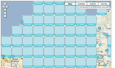
As the number of FOI's do increase steadily, it makes sense to "cluster" these instead of pointing to a cloud of FOI's.

Last week I came across this new feature called GEOCUBES developed by a Berlin (Germany) located company named Skilldeal.com.

Til end of Feb 2009 the Code (Javascript API, JS API Reference, client library PHP ) is free - I haven't had the time to test it - feel free to test it on your own !

(28.01.2009) One more comment:
I think there is no need for the GEOCUBES functionality in Oracle Maps, as we do influence the appearance of the FOI's according to the Zoom-Levels. In Mapviewer and Oracle Maps we can setup the layers in relation to a Zoom-Level.
This is different in Google Maps: there you do see ALL FOI's at all Zoom-Levels, and therefore it makes sense to use GEOCUBES.